Angora and Cobungra aerial baiting area
Wild dog program – aerial baiting Autumn 2024
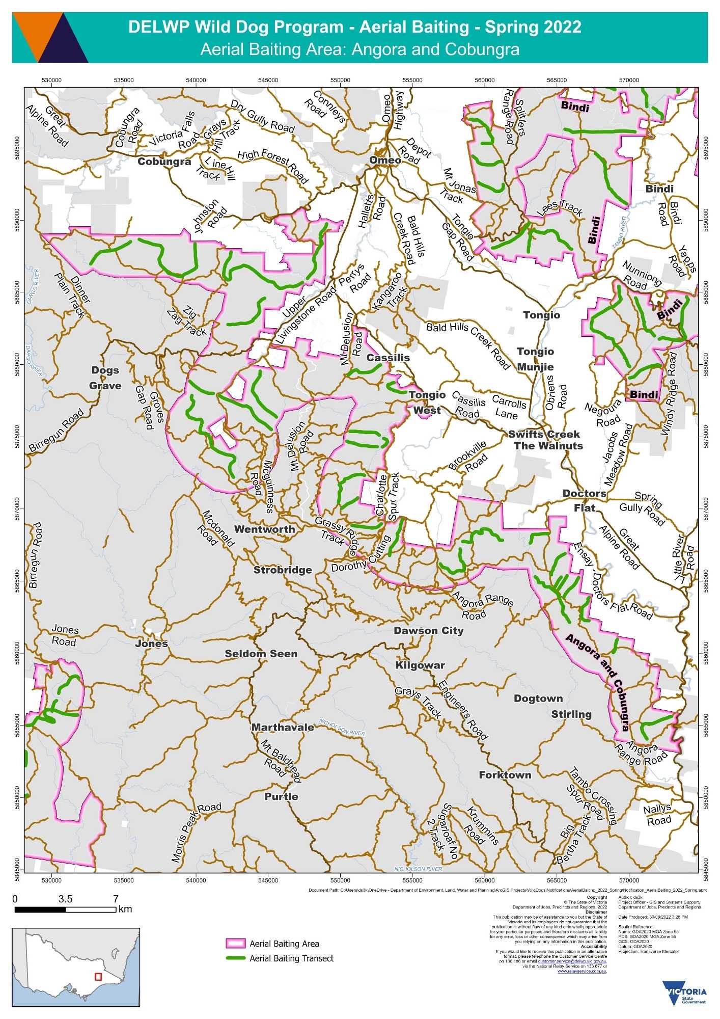
Angora and Cobungra aerial baiting area map (PDF - 1.7 MB)
Angora and Cobungra aerial baiting area interactive map
The Angora and Cobungra aerial baiting area occurs on public land which is within 3 kilometres of the public land and private land interface. Localities within the Angora and Cobungra aerial baiting area include:
- Brookville
- Cassilis
- Cobungra
- Doctors Flat
- Ensay
- Omeo
- Stirling
- Swifts Creek
- Tambo Crossing
- Tongio
- Wentworth
1080 baits have been dropped from a helicopter along transects located on public land:
- south of Cobungra
- north and east of Dogs Grave
- south west of Cassilis
- south west of Tongio West
- south of Swifts Creek
- south of The Walnuts
- south west of Doctors Flat
- north and east of Wentworth
- north east of Strobridge
- north of Dawson City
- north and east of Dogtown
- north and east of Stirling
Page last updated: 07 May 2024