Wabba aerial baiting area
Wild dog program – aerial baiting in autumn 2024
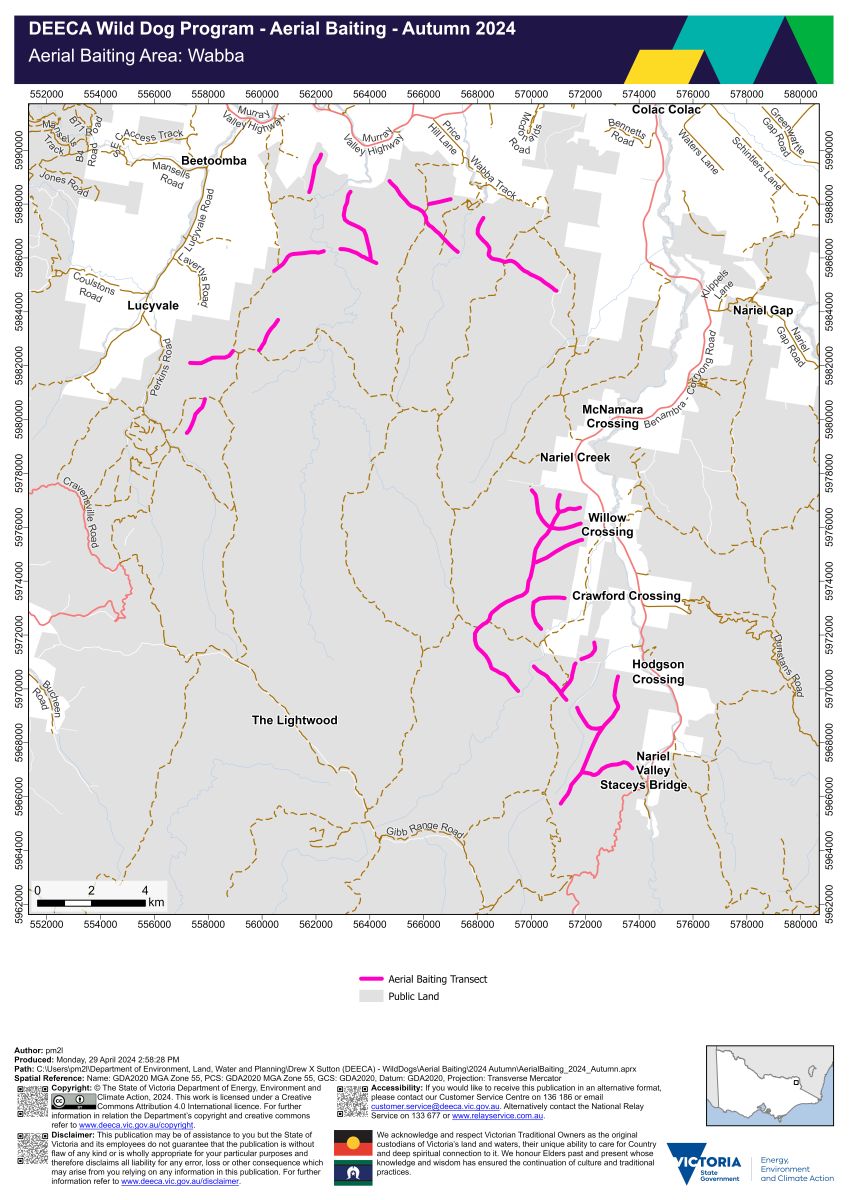
Wabba aerial baiting area map (PDF - 1.0 MB)
Wabba aerial baiting area interactive map
The Wabba aerial baiting area occurs on public land which is within 3 kilometres of the public land and private land interface. Localities within the Wabba aerial baiting area include:
- Berringama
- Cudgewa
- Lucyvale
- Nariel Valley.
1080 baits have been dropped from a helicopter along transects located on public land:
- south east of Beetoomba
- east of Lucyvale
- north and south of McNamara Crossing
- south of Nariel Creek
- west of Crawford Crossing
- west of Hodgson Crossing
- north west of Staceys Bridge
- east of The Lightwood.
Page last updated: 07 May 2024