New mapping tool will help predict the impact of future climate variability
Agriculture Victoria scientists are working with farmers, industry experts, other government agencies, and partners to develop a predictive tool that will help farmers and industry advisors make informed decisions about potential climate change impacts in their region.
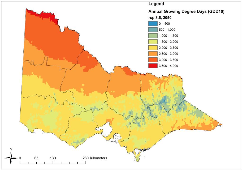
The Agriculture Climate Spatial Tool (ACST) will use advanced biophysical models to integrate land use information, industry information, and climate change projections for the years 2030, 2050, 2070, and 2090 for the two greenhouse gas Representative Concentration Pathways (RCPs) of 4.5 (moderate emission scenario) and 8.5 (high emission scenario).
The tool, which will be invaluable to farmers, industry advisors, and agriculture students will generate high-resolution information, maps, and analytics on climate thresholds (for example days above 40 degrees). It will also detail the potential impacts on agricultural productivity including changes in yield, phenology, irrigated water demand, and water availability. Growers and industry experts will have a strong involvement in developing the farming scenarios and testing the products.
Users will be able to examine maps and charts of grazing, cropping, horticulture, and forestry commodities at a range of scales from the farm up to statewide. The tool will also provide analysis for local government areas, Catchment Management Authorities, and industry regions.
The models will provide information to help farmers understand, adapt and make informed decisions about planting, water needs and future climate risks to production.
Sheep farmers and their advisers across the state will be able to investigate the potential future climate change impacts on their pastures, both by examining the predicted frequency and changes in the relevant climate thresholds and through the modelled impact on pasture productivity. Modelled productivity impacts for pastures (perennial ryegrass, cocksfoot, phalaris and lucerne) include seasonal live and dead dry matter, digestibility, and seasonal growth rates. Sheep farmers who also crop will also be able to get this information for crops (wheat, canola) including yield, growing season duration, growing season rainfall, and soil water at planting. Users will also be able to see predicted impacts on the water balance including runoff, recharge, evapotranspiration (ET), and top and subsoil moisture.
Prototype testing will commence in late 2023, and the tool will be available through an interactive online spatial viewer in 2024.
Learn more about how Agriculture Victoria is helping the agriculture sector respond to climate change and reduce emissions through its Agriculture Sector Pledge program of work that includes undertaking research trials to test methane inhibiting feed additives, delivering an innovative pilot involving 250 farm businesses in a free on-farm emissions assessment and delivering the tools and services to help farmers reduce emissions while maintaining productivity and profitability.
For more information about the ACST contact Dr Dugal Wallace, Research Leader, Landscape and Water Sciences, dugal.wallace@agriculture.vic.gov.au
