Burrowa aerial baiting area
Wild dog program – aerial baiting Autumn 2024
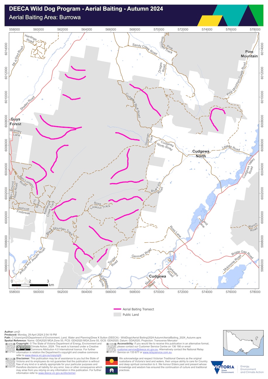
Burrowa aerial baiting area map (PDF - 1.3 MB)
Burrowa aerial baiting area interactive map
The Wabba aerial baiting area occurs on public land which is within three kilometres of the public land and private land interface. Localities within the Wabba aerial baiting area include:
- Berringama
- Cudgewa
- Lucyvale
- Nariel Valley
1080 baits have been dropped from a helicopter along transects located on public land:
- south east of Beetoomba
- east of Lucyvale
- north and south of McNamara Crossing
- south of Nariel Creek
- west of Crawford Crossing
- west of Hodgson Crossing
- north west of Staceys Bridge
- east of The Lightwood
Page last updated: 08 May 2024