Buchan and Gelantipy dingo predation management zone
Work plan 2025–26
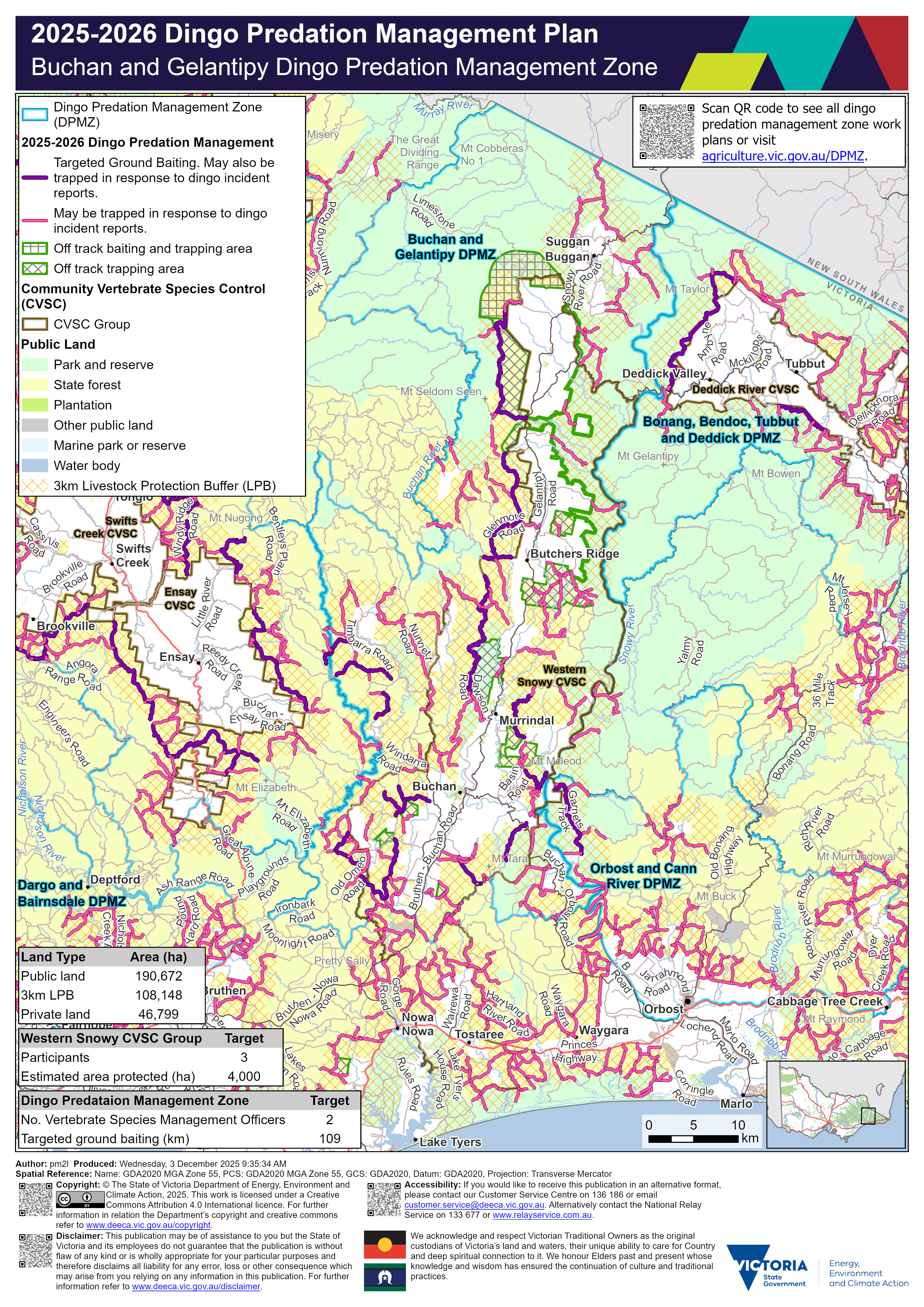
Details
Localities within the Buchan and Gelantipy dingo predation management zone include:
- Bete Bolong North
- Brumby
- Buchan
- Buchan South
- Butchers Ridge
- Cobberas
- Deddick Valley
- Double Bridges
- Gelantipy
- Murrindal
- Nowa Nowa
- Nunniong
- Suggan Buggan
- Timbarra
- W Tree
- Wairewa
- Wulgulmerang
- Wulgulmerang East
- Wulgulmerang West
Trapping activities in response to dingo related incident reports can be undertaken on the majority of tracks on public land within 3 km of the private land and public land interface surrounding the above mentioned localities.
Targeted ground-baiting transects are located on public land:
- west of Wulgulmerang
- west of Butchers Ridge
- east and west of Murrindal
- east, south, south-west and west of Buchan
Within the Buchan and Gelantipy dingo predation management zone there is 190,672 hectares of public land, 108,148 hectares of land under the 3 km livestock protection buffer and 46,799 hectares of private land. There are 2 Vertebrate Species Management Officers and 109 km of targeted ground baiting transects.
The Western Snowy Community Vertebrate Species Control group covers the majority of private land within the Buchan and Gelantipy dingo predation management zone.
The map should be read in conjunction with the accompanying Buchan and Gelantipy dingo predation management zone plan.
If you would like to receive this information in an accessible format, please phone 136 186, email customer.service@deeca.vic.gov.au, or via the Access Hub.